MY GEO Project
 – NEWS
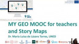

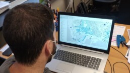
The last MyGeo Multiplier Event: MYGEO Mooc for teachers, Story Maps and QGis application
Four online events to show you how we can concretely work with GIS technology!
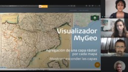
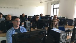
A report of the third MyGeo Multiplier Event: MyGeo Mooc for students, map viewer and RedFara
Four online events to show you how we can concretely work with GIS technology!
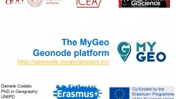
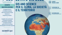
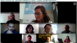
Second MyGeo Multiplier Event: Geonode platform and the use of GIS tools in cooperation projects
Four online events to show you how we can concretely work with GIS technology!
A report of the first MY GEO Multiplier Event
Four online events to show you how we can concretely work with GIS technology!
MY GEO Multiplier Events: professionals and academics experiences related to the use of GIS tools
Four online events to show you how we can concretely work with GIS technology!
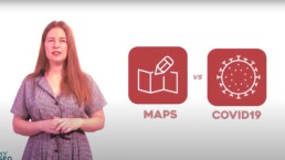
The role of maps in real life: mapping data related to the Covid-19 pandemic
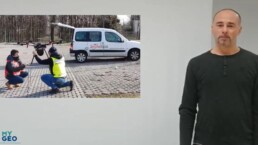
A GIS professional experience: maps and GIS technology in real life!
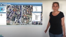
GIS technology: the availability of a reliable, verified, integrated and updated information
A GIS professional experience: attractive geo tools, are they possible?
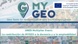
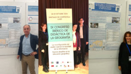
MyGeo Project activities: National Conference of Spanish Geographers, EUROGEO Conference and IGC 2021
A quick update about MyGeo Project activities
GIS technology to solve problems with land use visualization
A GIS professional experience: the use of GIS to interconnect geographical, geological, heritage and economic variables.
GIS technology in the field of archaeology and sustainability
A GIS professional experience: the use GIS to improve the documentation techniques in the field of archaeology

GIS experience: the use of GIS technologies to take better decisions
A GIS professional experience: the use of GIS to improve Africa conditions
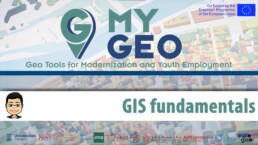
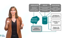
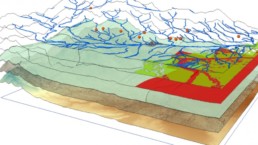
GIS Fundamentals: the bases of GIS technology, what it is and how it works
Hardware, software, processes, data and users are the 5 most important GIS elements: discover how they work together to improve the GIS community!
MyGeo mobility: two students from Zaragoza hosted in A.R.S. Progetti
Students report about their internship with A.R.S. Progetti
Gross Domestic Product on online maps in a story map. An indicator related to the SDGs?
The MyGeo project and the MOOC for teachers in the XX Madrid Science Week! A video by UNED about the use of maps for the GDP related to the SDGs.
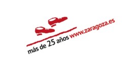
MyGeo Project at Zaragoza City Council
The Zaragoza City Council website has more than 25 years of experience since its launch in 1994. For this reason, the Office for Participation, Transparency and Open Government is organizing a conference. In this first edition, open data will be the protagonists and MyGeo Project will be presented .
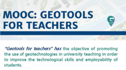
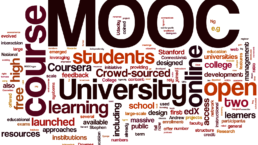
New goal for My Geo Project: The MyGeo MOOC for teachers is online!
From Friday 6th November the MyGeo Mooc for teachers, one of the Intellectual Output of MyGeo project, is online. You can register for free and start the online course!
GIS matters everywhere: Geo Tools for Employability
GIS is a key element for the current transformation of our society and provide so many opportunities in so many different fields and occupations.
GeoNovember 2020: the third edition and the collaboration with the MyGeo project!
The month of November between Geography, GIS and GIScience: the third edition of GeoNovember !
MyGeo MOOC for students at the International University Congress on content, research, innovation and teaching
The My Geo project and the MOOC for students at the International University Congress
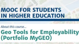
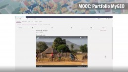
The MyGeo MOOC for students – Portfolio MyGeo is online!
From Tuesday 6th October the MyGeo MOOC for students, the first Intellectual Output of the MyGeo Project, is online.
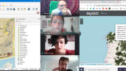
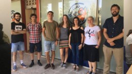
Final evaluation meeting: the conclusion of the virtual mobility between UNIPD and Geoslab
Susana, Javier and the two students Alice and Matilde partecipated to the final online meeting between UNIPD and Geoslab and tested the MOOC Preview.
Follow up meeting with students
Follow up meeting in smartworking between students from Master in "GIScience e droni per la gestione del territorio"
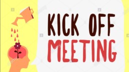
Kick-off meeting for the traineeship of students
Kick off meeting in smartworking between partners of the MYGEO project
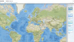
MapMaker Interactive: a useful tool to support interactive mapping
MapMaker Interactive allows you to explore different spatial phenomena by adding data layers to your base map. This map is designed to be used as a general reference map for informational and educational purposes as well as a basemap by GIS professionals and other users for creating web maps and web mapping applications.
UNESCO Bangkok, GIS and human trafficking.
Datasets regarding human trafficking are somewhat limited, making any recent literature or projects that incorporate GlS a bit uncommon, but UNESCO initiated the Social Sentinel Surveillance Project, a GIS-linked system connecting databases with information related to human trafficking of some areas.

Use GIS to help children understand COVID-19
With GIS technology it is possible to explain Coronavirus to children. Mapping the epidemic and analyzing epidemiological factors promotes understanding.

Northern Kentucky tackles the Opioid Epidemic
The story map provides Northern Kentucky with information to combat opioid addiction.
A Case Study by Esri. Health and Human Services to create a healthier community.
A collaborative approach to working with Homelessness
Solve homelessness and homeless camps problems with the GIS technology: a Case Study by Esri. Health and Human Services to create a healthier community.
FAO and GIS: sustainable agriculture and food security
FAO and GIS technology, the employment of new geospatial technologies for comprehensive worldwide assessment of environmental conditions and the monitoring of their dynamics.

GIS technology and the impact on education
The impact of GIS technology on education. An example of teaching tool: EduGIS!
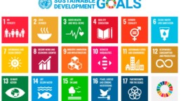
Gis technology for “The future we want”!
The importance of GIS technologies in achieving the 17 Sustainable Development Goals of Agenda 2030
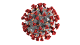
Mapping the novel coronavirus outbreak with a GIS dashboard
An interactive map, visualized through a Graphic Information System, is providing near real-time tracking to show all confirmed and suspected cases of coronavirus, along with recovered patients and deaths. Let's see how it works!
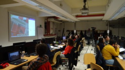
Focus group of Students in Padua
Between December 2019 and January 2020, three focus groups were carried out, involving a total of 36 students from the University of Padua. Check it out!
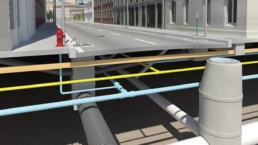
The GIS and BIM alliance
Integration between GIS and BIM will transform infrastructure design and construction, with the aim to create smarter and more working cities.
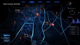
Using GIS technologies for the development of Smart Cities
A concrete example on the use of GIS technologies for the development of the "Smart City" concept
Focus groups of teachers and students in Zaragoza
New focus groups of students and teachers implemented at the University of Zaragoza: read their outcomes.
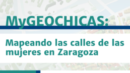
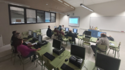
My GEOCHICAS: Mapping the streets of women in Zaragoza.
On February 13, the My GEO project carried out an interesting initiative in Zaragoza. Check it out!
How the use of GIS is revolutionizing the world! – part 3
Concrete examples of projects carried out through the use of GIS technologies. Discover all the possibilities that the GIS offers and imagine what can you do!
How the use of GIS is revolutionizing the world! – part 2
Concrete examples of projects carried out through the use of GIS technologies. Discover all the possibilities that the GIS offers and imagine what can you do!
How the use of GIS is revolutionizing the world! – part 1
Concrete examples of projects carried out through the use of GIS technologies. Discover all the possibilities that the GIS offers and imagine what can you do!

What is GIS (Geographic Information System)?
A collection of computer-based tools created for the organization of information from a variety of data sources aimed to map and examine changes on Earth.

What is “MY GEO Mobility”?
A description of the third Intellectual Output of the MY GEO Project, aimed at fostering the acquisition of key skills on the use of GIS tools and targeted to students in higher education.
What is the Portfolio MY GEO?
A description of the second Intellectual Output of the MY GEO Project, aimed at fostering the capacity of students in higher education to acquire key skills related to the use of GIS applications .
What is the “MY GEO” MOOC for teachers?
A description of the first Intellectual Output of the MY GEO Project, aimed at promoting the modernisation of teaching methods and learning tools through the use of GIS technologies.
MY GEO’s partners presenting the project
In recent months, during several international conferences, the teams of UNED and UNIZAR, partners of the "MY GEO" project, talked about new GIS technologies and presented "MY GEO" Project.
Students of Ghent University start internship at Geoslab in Zaragoza
From July 2019 students from Ghent University have started their internship at GeoSLab - company based in Zaragoza (Spain) - in the frame of MY GEO (Geo Tools for Modernization and Youth Employment), project.

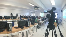
Focus group of Students in Zaragoza
On the 9th of May 2019, a focus group of 24 students has been organised by the University of Zaragoza: the students have discussed about the competences, related to the use of GIS tools, most commonly requested by the job market.
Focus group of Teachers in Zaragoza
The partner organizations of the "MY GEO" project are running focus groups of Unviersity teachers with the aim of identifying key competences related to the use of GIS tools in higher education. Here are reported the main conclusions of the focus group of teachers organised by the Unviersity of Zaragoza.
Focus group of Teachers held in Madrid
The four partner Universitites of "MY GEO" are implementing "focus groups" of teachers meant to identify a set of key competences needed to teach GIS in higher education courses. Here is the report of the focus group organised by UNED and held in Madrid
Focus group of Students in Padua
On the 5th of April 2019, on the occasion of the "Geography Night" event held in Padua and organised by the University of Padua in callaboration with Archetipo S.r.l., the project "MY GEO" has been introduced to a focus group of students.
The MY GEO Blog
The "MY GEO Blog" is a section of the website containing news, photos and reports on the ongoing activities of the project implemented by its partner organizations.
Supported by