MY GEO Project
 – MOOC Release
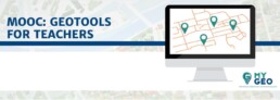
The MyGeo MOOC for teachers has been released and it is now available and open for everyone!
You can register at this link and start the course immediately! The course is available in English, Spanish, Italian, French and Dutch.
The MyGeo MOOC for teachers is an online course for teachers aimed at fostering the acquisition of key competences related to the use of GIS in higher education courses and to promote the modernization of teaching methods and tools in higher education institutions. Geotools for teachers has the objective of promoting the use of geotechnologies in university teaching in order to improve the technological skills and employability of students.
Download the Leaflet and share it!
– “MY GEO” MOOC FOR TEACHERS
The “MY GEO” MOOC is an online course for teachers aimed at fostering the acquisition of key competences related to the use of GIS in higher education courses, with the ultimate objective of promoting the modernization of teaching methods and tools in higher education institutions.
The MOOC will be realized following a process of research, identification and validation of key skills and concrete examples on the use of GIS tools in higher education. Each GIS tool identified will be associated to a set of key skills needed to make proficient use of it.
The MY GEO MOOC for teachers will be composed by different modules: each module will foster the acquisition of a number of key skills previously identified. This organization of contents, besides facilitating the navigation among the MOOC’s modules, will allow the user to autonomously define its “training needs”: in relation to the GIS tools of interest.
In this sense the MOOC will be interactive and adaptable to the needs of its users. The contents of the MOOC will be continuously accessible – 24 hours a day, 7 days a week – from anywhere and at any time, without need to respect the timing set by the MOOC.
Each module will include: documents, text, slides, videos, links to online resources as well as tools for the evaluation of its “learning impact” towards the user.
– CHAIN OF ACTIONS
The partner institutions will initially edit a “State of the art review” (SoA): a research and collection of existing experiences on the use of GIS in higher education, with a focus on good practices and lessons learned.
From the analysis of the experiences gathered in the SoA, the partners will identify a set of key competences related to the use of GIS: with a specific focus on the most requested skills by the labor market.
In line with the competences identified the partner institutions will build a “training curriculum“: a training plan for university teachers, aimed at the acquisition of basic skills that favor the use of GIS in teaching.
The contents developed will be verified and validated by the target population: university teachers who will be consulted through the organization of focus groups.
Each partner institution will organize a focus group of at least 10 teachers: for a total of four focus groups and 40 teachers involved in the analysis and evaluation of contents produced.
All contents produced and validated by the target population will be collected in the first version of “MY GEO – MOOC for teachers”. The latter will be submitted again to the attention of the focus group members, who will test its use and will give feedback on the perceived quality and relevance of contents and on the capacity of the tool to favor the effective acquisition of skills by the target population.
The activities described above will constitute the WP2 aimed at favoring the “MODERNIZATION” of the partner institutes through the use of GIS tools for teaching / learning.
The WP will be coordinated by UNED due to its expertise in the use of innovative teaching / learning tools at a distance. All the partner institutions will collaborate and contribute to the production of the Intellectual Output: each according to its specific know-how.
Supported by