MapMaker Interactive is a tool to support interactive mapping; it allows you to choose from a variety of base maps depending on the information you want to display on your map.
MapMaker Interactive allows you to explore different spatial phenomena by adding data layers to your base map. This map is designed to be used as a general reference map for informational and educational purposes as well as a basemap by GIS professionals and other users for creating web maps and web mapping applications.
The map was developed by National Geographic and Esri and reflects the distinctive National Geographic cartographic style in a multi-scale reference map of the world. The map was authored using data from a variety of leading data providers, including Garmin, HERE, UNEP-WCMC, NASA, ESA, USGS, and others. This reference map includes administrative boundaries, cities, protected areas, highways, roads, railways, water features, buildings and landmarks, overlaid on shaded relief and land cover imagery for added context.
How to use it?
Using the “Add Layer” button you can choose from an array of fascinating layers. You can project multiple layers at a time, arrange these layers, and change their transparency to explore spatial relationships.
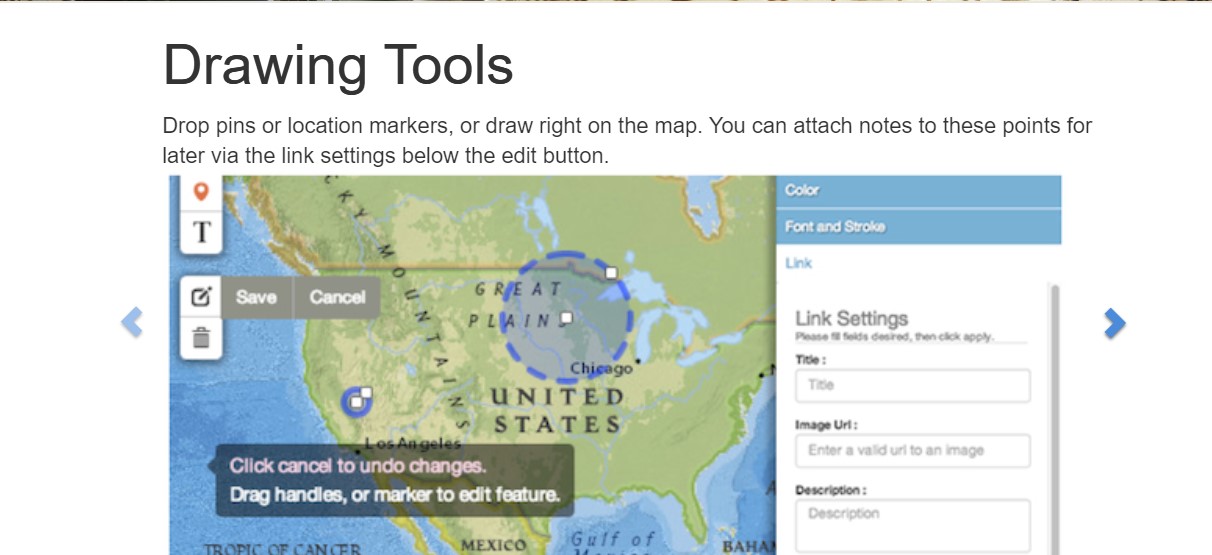
Using the Drawing Toolbar, you can add lines, rectangles, circles, polygons, and labels to your map. Use the Editing Palette to change the color, stroke, or size of your object or text.
MapMaker Interactive allows you to draw lines on your map while also producing measurements of that line in real geographic space. You can also edit your line using the Editing Palette to change its color, stroke, style, or measurement unit.
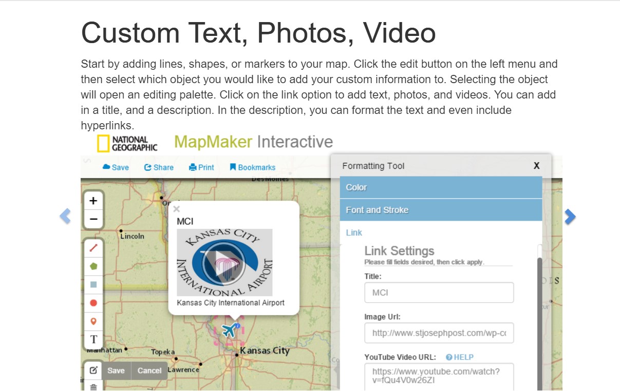
You can also customize your maps by adding photos, videos, and descriptions to features on your map.
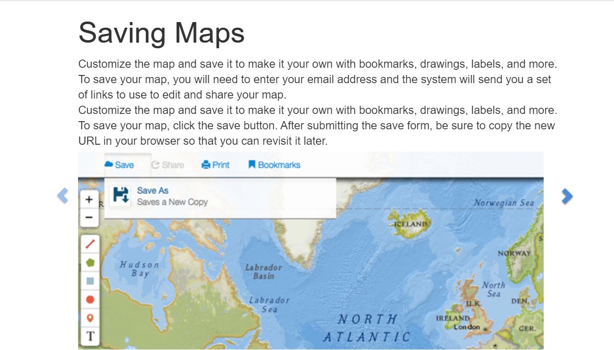
You can save your custom map in MapMaker Interactive simply by navigating to the “Save” icon. MapMaker will send you two links to your map, one that allows you to update and edit the map at a later time and another that creates a “read-only” version that you can share with family and friends. You can also bookmark your map for later use in a GeoTour.
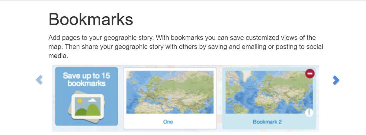
MapMaker Interactive allows you to turn your custom maps into bookmarks. These bookmarks allow you to tell a geographic story. After turning your maps into bookmarks, you can edit them, rearrange their order, or place new data layers on top of them to explore even more!
MapMaker Interactive gives you the opportunity to learn about any country around the world. Simply enable the “Country Flags and Facts” feature in the Drawing Toolbar and click on a country of interest to sharpen your geographic knowledge.
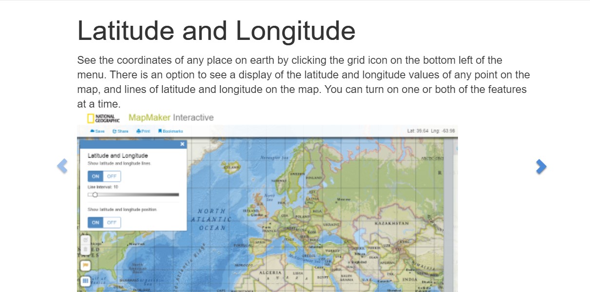
MapMaker Interactive allows you to project lines of latitude and longitude on your map to help reference your features in geographic space.