
The Problem
The Municipality of Anchorage, an unified home rule municipality in the U.S. state of Alaska, on the West Coast of the United States, is facing a growing problem of homelessness and homeless camps.
‘Housing First’ as a way to end homelessness is the method being used in Anchorage, an initiative led by Nancy Burke, the Homeless and Housing Coordinator.
Nancy partnered with the Geographic Data and Information Center (GDIC), part of the Office of Economic and Community Development, as she began to develop a holistic approach to understanding and responding to the problem of homelessness in Anchorage.
GDIC supported the efforts utilizing multiple ArcGIS products to gather, analyze, and share data with stakeholders and residents.
“We have been able to take an agile approach using GIS, allowing us to change from our original direction without wasting any time or resources.”
-Tina Miller, Geographic Information Officer, Municipality of Anchorage GDIC


The challenge
As the number of homeless people populating the streets and public facilities of Anchorage grew, the Mayor’s staff needed a way to keep track of camps and interactions with neighboring businesses and neighborhoods in an efficient and timely manner.
One of the main concerns was the ability to quantify the current data and examine where homelessness was impacting the community.
There was a strong desire to approach the problem from a data perspective; to visualize, analyze, and then share that information with relevant stakeholders; this is where GDIC was brought in to help.
GDIC wanted to help the Mayor’s staff provide residents with more accurate information about how local communities and government can work together to address complex issues using technology.
There were several opportunities for data collection and portrayal of information that were not fully captured in prior years, including an annual Point In Time count, required in the community by Housing and Urban Development (HUD), a Municipal ordinance to provide social services contacts to homeless persons found in camps, and coordination between Municipal departments on cleaning camp locations after vacancy.
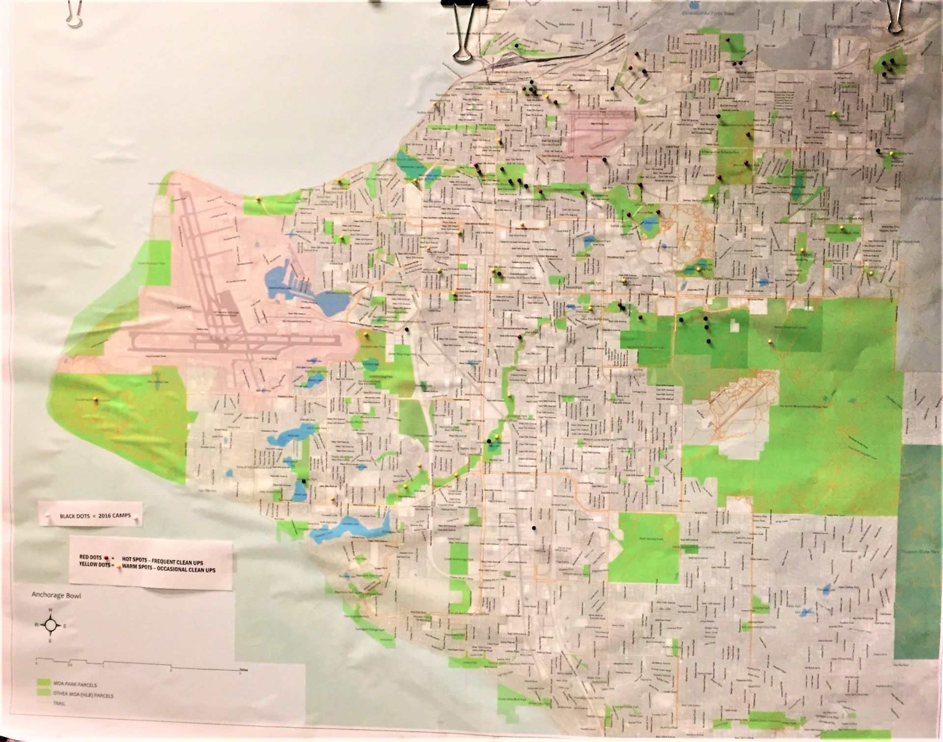
Maps that used to be printed and utilized pushpins and manual management became digitized.
Surveys that used to be paper were turned into mobile-friendly forms.
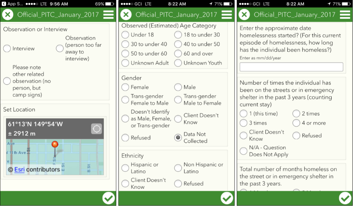
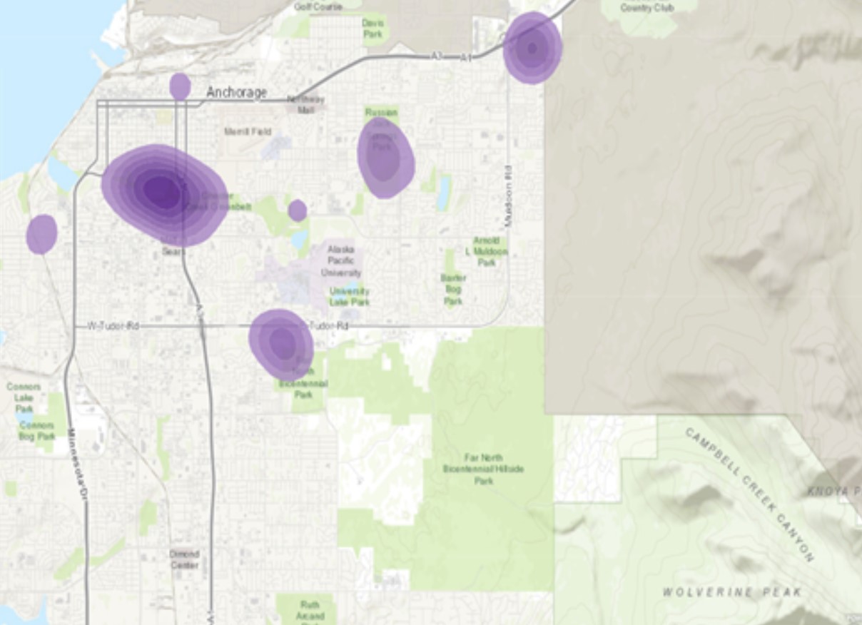
The first step in this process was to make the annual homeless Point-In-Time count digital and gain a geographic perspective of how this information could be used to make an impact on homelessness as a mechanism for coordinating outreach to the homeless and as a way to provide real time data on the locations of camps.
The solution
Anchorage chose a configure-first approach, using multiple items in the Esri® ArcGIS Online software suite.
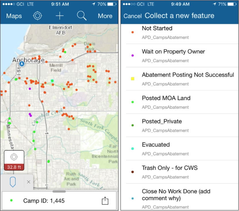
These included Survey123 for ArcGIS and Collector for ArcGIS, configurable apps for collecting data in the field. Survey123 for ArcGIS fit staff’s needs perfectly for their upcoming homeless point-in-time count.
Next, GDIC employed Collector for ArcGIS in various departments, such as Anchorage Police Department and Anchorage Parks and Recreation, to easily share maps and data collected at homeless camps via mobile devices. This enabled the police and social services outreach workers to find and assist the homeless campers more easily and to refer the sites for cleanup once the camps were vacated.
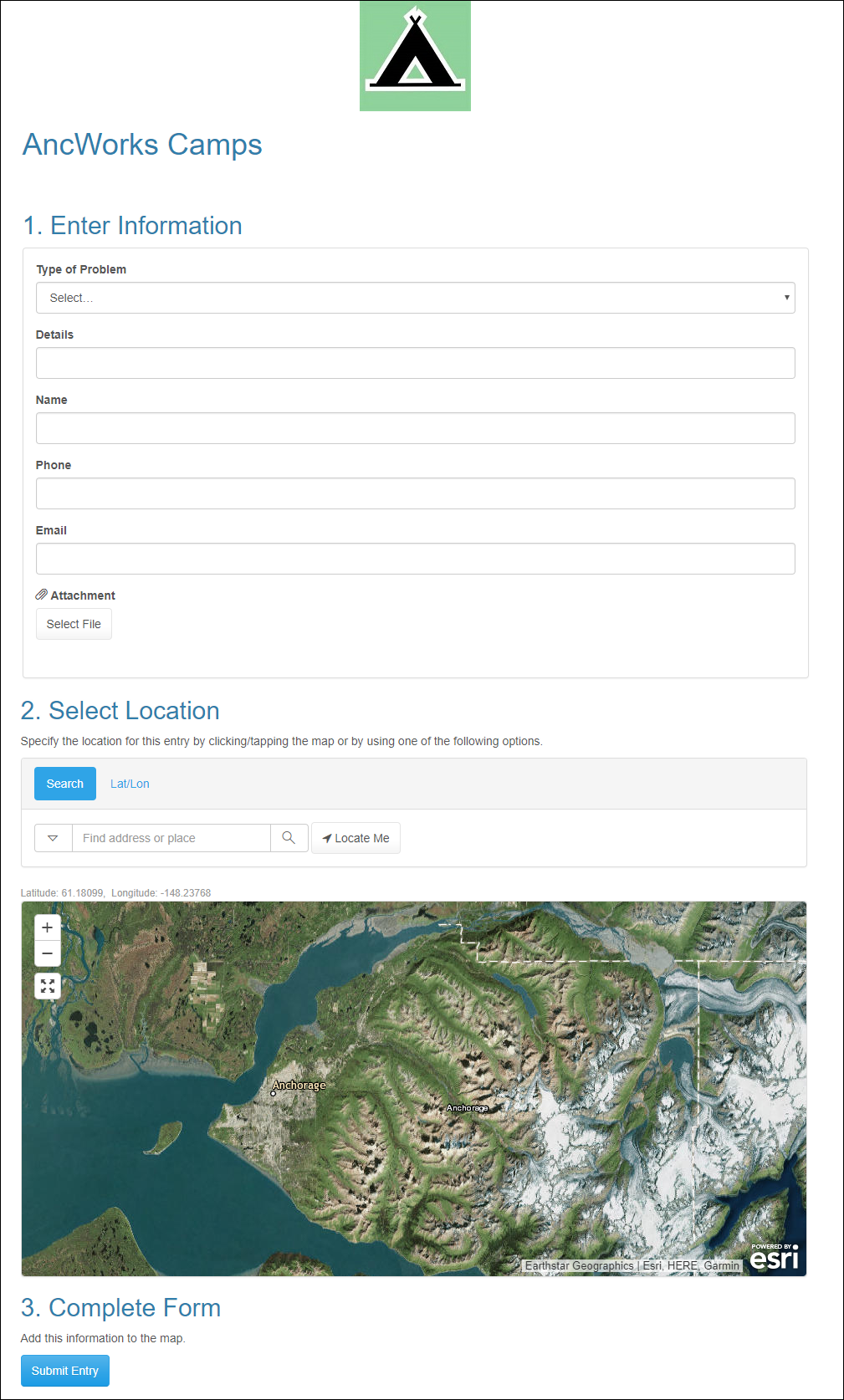
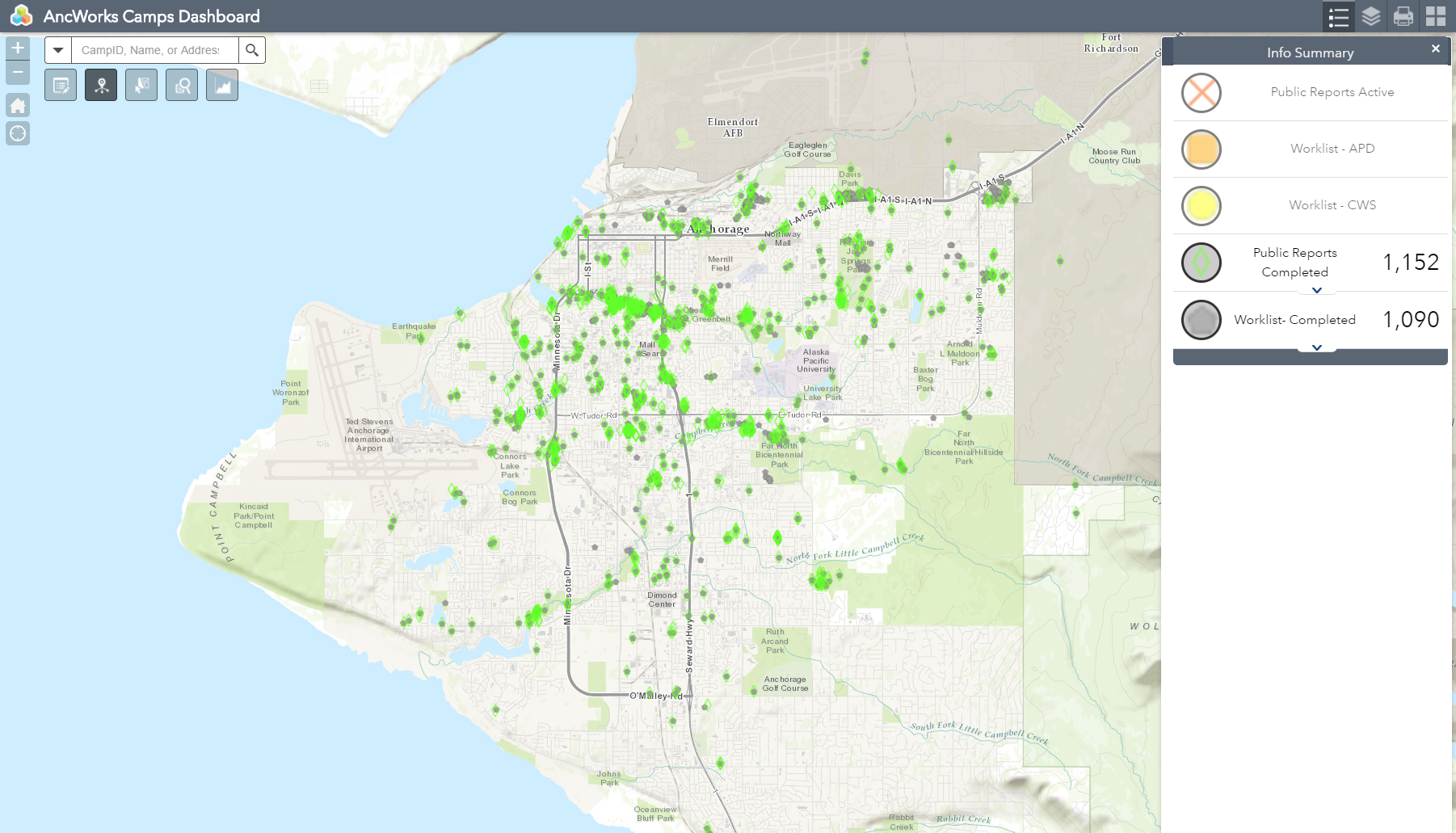
Using ArcGIS Online, GDIC created their AncWorks Camps Dashboard. Employing the Esri GeoForm template, they incorporated residents’ input of camp locations into the management tool monitored by GDIC and the mayor’s office.
The Results
Since implementation, two annual homeless point-in-time counts have been conducted, increasing the community’s ability to accurately count the individuals and camps. Each year, over 150 volunteers use Survey123 with minimal training to accomplish the homeless count in just one day.
By using Esri apps for field data collection and sharing, Anchorage has moved from performing a paper-and-pencil count in a loosely organized outreach effort to using a new system informed and organized by GIS data, resulting in a faster, more accurate, and more useful process for everyone.
The increased amount of information gathered about homeless camps and the needs of the people observed has also deepened the city’s understanding of its homeless population. The mayor’s office, in conjunction with the community social service providers, was able to incorporate a new requirement to conduct an assessment of the medical needs of the persons in camps.
Through collection of this information, outreach and social services teams have been better able to provide help in getting medical and mental health care. The information has also enhanced social services response through the development of a coordinator position located within the Anchorage Police Department to help connect homeless individuals with needed resources quickly.
From here, the Municipality of Anchorage wants to use GIS to answer questions about available social services and how to connect the homeless population with them as they continue to focus on housing first as a solution to end homelessness in the community.
Credits to ESRI