
The Problem
While serving over 400,000 residents, the Northern Kentucky Health Department (NKHD) strives to be a valued leader and community partner in preventing disease, promoting wellness, and protecting the community from health threats. When NKHD began to see a drastic rise in opioid-related overdoses and deaths, the question was asked as to how to communicate the severity of the epidemic to the Northern Kentucky community.
Geographic information system (GIS) technology provided the answer.
“The purpose of the Story Map is to educate and create awareness. And that is what the Story Map is doing for Northern Kentucky.”
– Debbie Young (Public Health Informatics Manager) & Ned Kalapasev (GIS Manager), Northern Kentucky Health Department
The Challenge
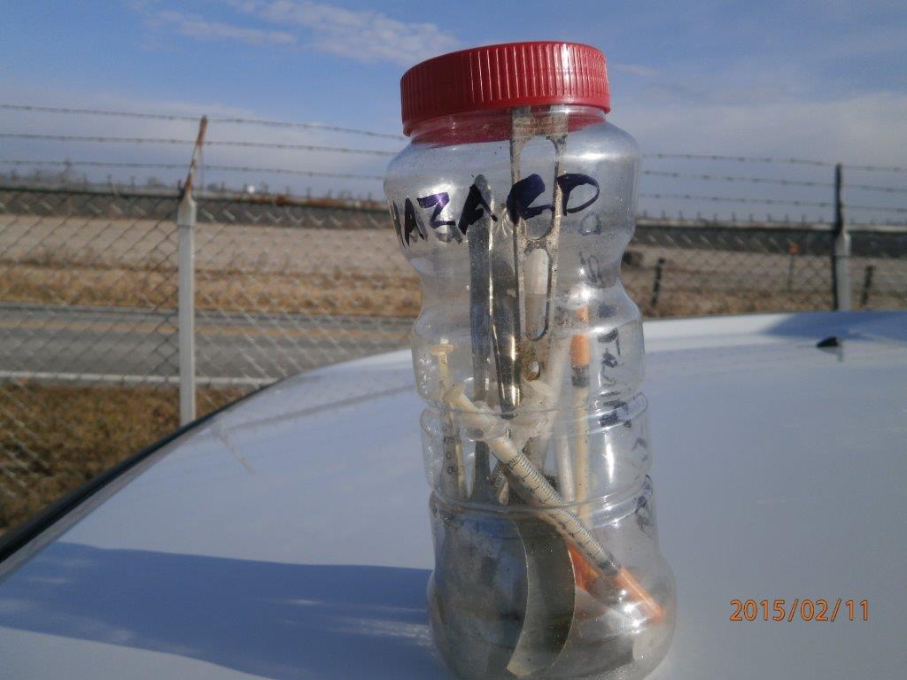
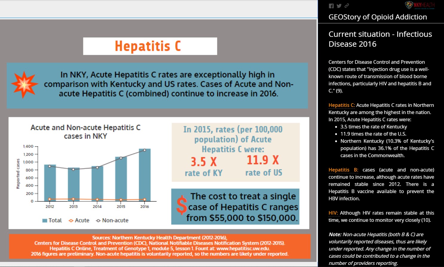
Even before the opioid epidemic was declared a national emergency, Northern Kentucky had begun to see its impacts, including an increase in overdoses and overdose deaths, an increase in cases of hepatitis C -many of which were tied to injection drug use- and increases in drug-related crimes.
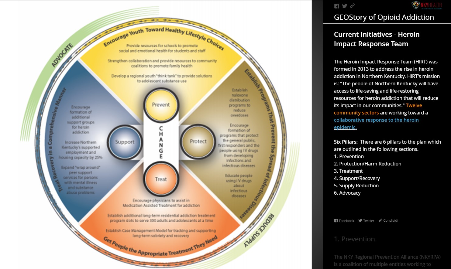
The Heroin Impact Response Team (HIRT) was formed in 2013 to fight the opioid epidemic.
HIRT faced a tough challenge with one person dying every 40 hours from an opioid overdose. With multiple data sources housed at different agencies, it was difficult to monitor data trends and collaborate on a unified response.
To better assist members of HIRT and the broader community understand the scope and impact of the opioid epidemic, NKHD saw the need to put together a central repository for the data.

The Solution
NKHD found Esri Story Maps to be a robust solution to share data and portray the complexity of the opioid epidemic and its related problems.
The story map format provided an engaging, understandable, and visually pleasing tool to demonstrate how the epidemic was impacting the community.
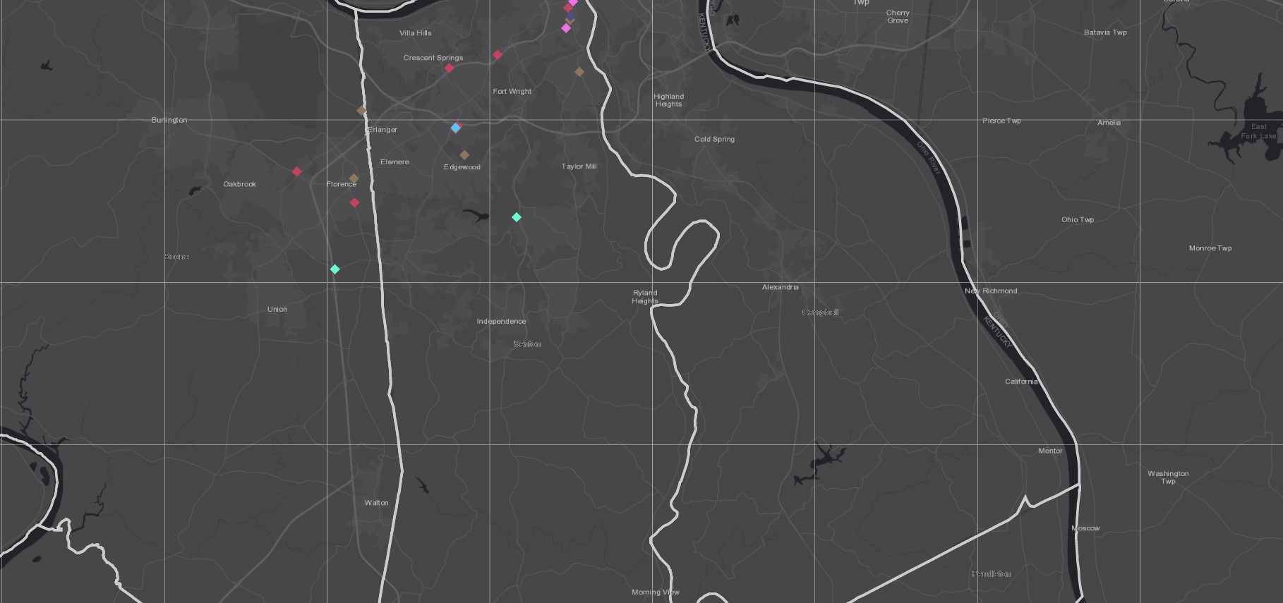
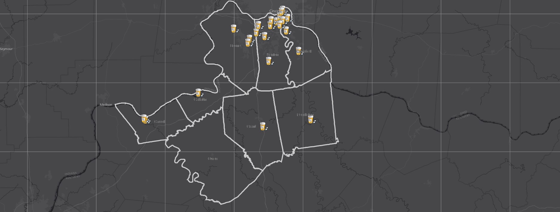
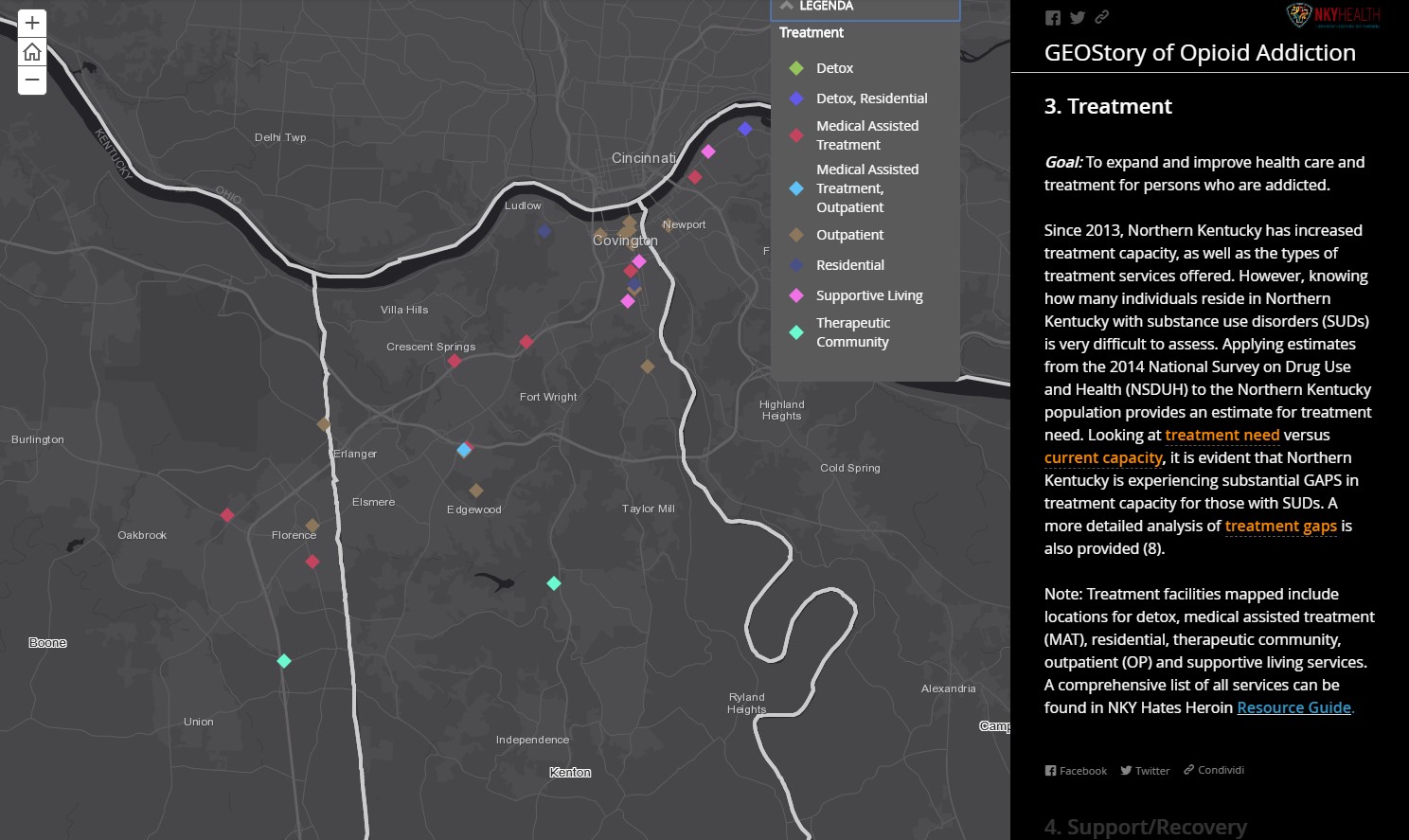
Interactive map N.1: Opioid Treatment Locations
The story map also provided flexibility for users, giving them the ability to quickly view high level data, to dig deeper and look for trends in data over time, or to look at county or ZIP code specific data.
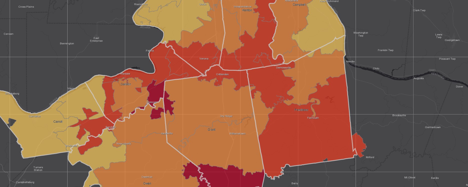
Interactive map N.2: Morphine Equivalent Dosage (MED) Rates by ZIP Code 2015/2016
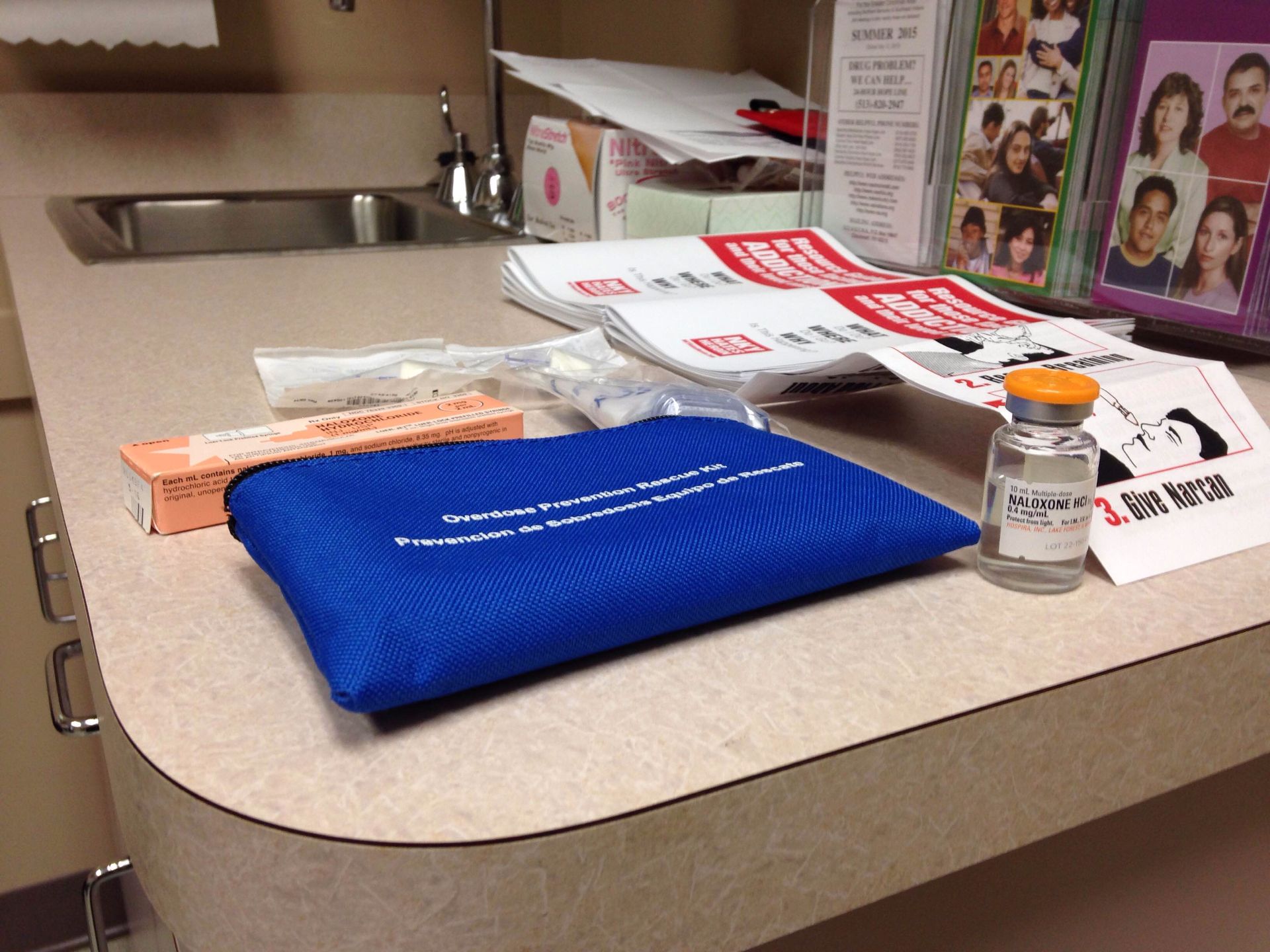
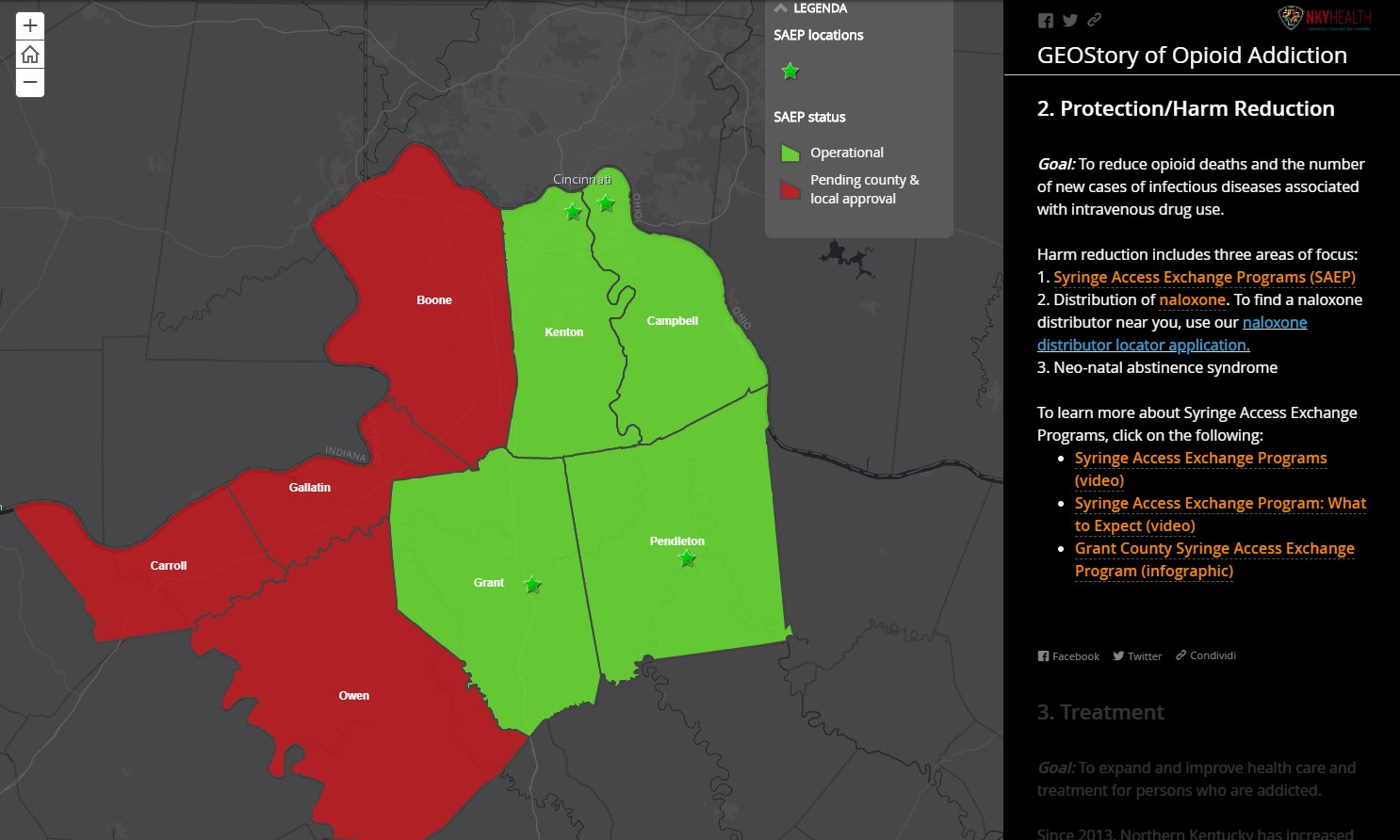
Additionally, the story map allowed NKHD to promote resources, such as the drug drop-off locations, syringe access exchange program, and the local substance abuse helpline.
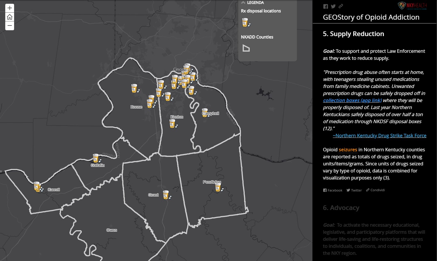
Interactive map N.3: Drug Drop-off Locations
The Results
Since the release of the NKHD story map— GEOStory of Opioid Addiction—it has received more than 15,000 views; averaging 50 per day. Information is vital to deepening the community’s understanding of the opioid epidemic.
The story map provides Northern Kentucky with information housed in a central location for use by the community and partners to combat opioid addiction. Various agencies—such as police, jails, the Northern Kentucky Regional Prevention Alliance, and the substance abuse hotline—are provided with a platform to share data and communicate their initiatives.
Ultimately, the NKHD story map increased the community’s awareness of the epidemic’s severity, the resources that are available to the community, and how NKHD, HIRT and other local organizations are doing their part to tackle the opioid crisis.
For more information on how to tackle the opioid crisis, visit: http://go.esri.com/GISforOpioidCrisis


Credits to ESRI