The second Multiplier Event promoted by the MYGEO Project has been held on Wdnesday the 12.5. The event was aimed at collecting good practices and experiences by Academics and professionals making use of GIS tolls in their daily work.
The first two sessions were held by Padua University.
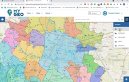
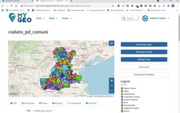
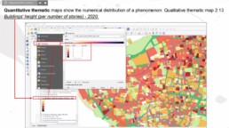
In particular, Daniele Codato, a post doc researcher, illustrated the Geonode Platform, a tool in support of those interested in the use of Geospatial Information Systems (GIS).
Where can I get geodata and how can I share my data with other people, collaborating with them? The Geonode platform answers these questions, especially for young people looking for the possibility to share their abilities in mapping and in the use of GIS tools. The Geonode platform represents a real opportunity to be known by firms interested in web GIS abilities.
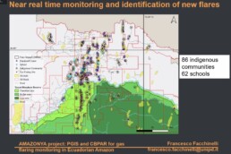
In the following session, Francesco Facchinelli explained the work of the research group on Climate change, Territories and Diversity, with which he collaborates. He presented the Amazonya Project, in which they developed a participatory GIS mapping on gas flaring in Ecuadorian Amazon.
The last topic was held by A.R.S. Progetti, a consulting firm working all over the world to provide benefits and to help improving countries.
A.R.S. Progetti shown how to use GIS tools in cooperation projects, in particular during the realization of Zanzibar Stone Town conservation and heritage management plan.
GIS has been an important component in the whole process, reviewing existing and previous data, integrating information needed and analyzing the actual situation in order to develop a really working plan.
Don’t miss the next MY GEO Multiplier events: see on following the scheduled sessions and the experts involved!
MULTIPLIER EVENT N.3 – MYGEO Mooc for students and map viewer – RedFara: surveillance of plant health 18.5 at 15h
University of Zaragoza (Spain):
The MYGEO MOOC for Students and the MYGEO map viewer
Geospatiumlab (Spain):
RedFara: the information system for surveillance of plant health in Aragòn, Spain
Registration Form: https://forms.gle/jAuziAHLHdkHsWDv8
MULTIPLIER EVENT N.4 – MYGEO Mooc for teachers and Story Maps – QGis application 28.5 at 17h
National Distance Education University (Spain):
Story Maps
ARCHETIPO (Italy):
QGis application for the analysis and visualization of image data for Precision Farming and for monitoring the efficiency of large photovoltaic systems
Registration Form: https://forms.gle/9oGevLb6ELRZgpJB7
To attend the sessions a registration is required.
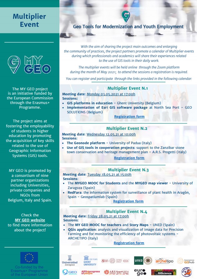
MyGeo Multiplier Event Leaflet