
How the use of GIS is revolutionizing the world! – part 1
Concrete examples of projects carried out through the use of GIS technologies. Discover all the possibilities that the GIS offers and…
0 Commenti2 Minuti
How the use of GIS is revolutionizing the world! – part 2
Concrete examples of projects carried out through the use of GIS technologies. Discover all the possibilities that the GIS offers and…
0 Commenti2 Minuti
How the use of GIS is revolutionizing the world! – part 3
Concrete examples of projects carried out through the use of GIS technologies. Discover all the possibilities that the GIS offers and…
0 Commenti1 Minuti
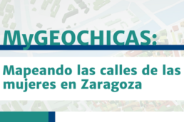
My GEOCHICAS: Mapping the streets of women in Zaragoza.
On February 13, the My GEO project carried out an interesting initiative in Zaragoza. Check it out!
0 Commenti1 Minuti
Focus groups of teachers and students in Zaragoza
New focus groups of students and teachers implemented at the University of Zaragoza: read their outcomes.
0 Commenti1 Minuti
Using GIS technologies for the development of Smart Cities
A concrete example on the use of GIS technologies for the development of the "Smart City" concept
0 Commenti1 Minuti
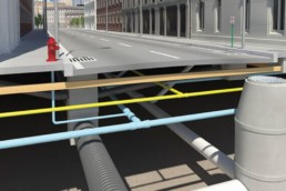
The GIS and BIM alliance
Integration between GIS and BIM will transform infrastructure design and construction, with the aim to create smarter and more working…
0 Commenti1 Minuti

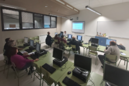
Focus group of Students in Padua
Between December 2019 and January 2020, three focus groups were carried out, involving a total of 36 students from the University of Padua.…
0 Commenti2 Minuti
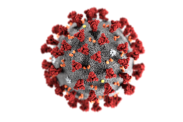
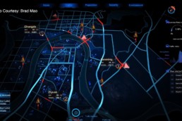
Mapping the novel coronavirus outbreak with a GIS dashboard
An interactive map, visualized through a Graphic Information System, is providing near real-time tracking to show all confirmed and…
0 Commenti2 Minuti
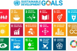
Gis technology for “The future we want”!
The importance of GIS technologies in achieving the 17 Sustainable Development Goals of Agenda 2030
0 Commenti2 Minuti

GIS technology and the impact on education
The impact of GIS technology on education. An example of teaching tool: EduGIS!
0 Commenti2 Minuti
FAO and GIS: sustainable agriculture and food security
FAO and GIS technology, the employment of new geospatial technologies for comprehensive worldwide assessment of environmental conditions…
0 Commenti3 Minuti